 |
GlsMap Toolkit
1.10.3
|
|
GlsMap Toolkit
1.10.3
|
#include <gls_map_ecrg.h>
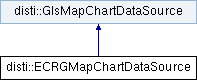
 Inheritance diagram for disti::ECRGMapChartDataSource:
Public Member Functions | |
| GLSGEN_GLSMAPECRG_EXPORT | ECRGMapChartDataSource (EcrgJustInTimeFileLoading isUsingJustInTime=ECRG_PROCESS_LATER) |
| GLSGEN_GLSMAPECRG_EXPORT void | ParseDirectory (const char *directoryPath, EcrgParseDirectoryRules isUsingTocFile=FIND_ECRG_TOC) |
| GLSGEN_GLSMAPECRG_EXPORT void | ParseDirectoryForLocation (const char *directoryPath, const double longitude, const double latitude, const double parseRadius) |
| GLSGEN_GLSMAPECRG_EXPORT unsigned int | GetLayerCount () const |
| GLSGEN_GLSMAPECRG_EXPORT EcrgJustInTimeFileLoading | IsEcrgJustInTimeFileLoadingEnabled () const |
| GLSGEN_GLSMAPECRG_EXPORT void | SetTargetCellLoadRate (const double targetCellLoadRate) |
| GLSGEN_GLSMAPECRG_EXPORT double | GetTargetCellLoadRate () const |
| GLSGEN_GLSMAPECRG_EXPORT std::set< EcrgDataSeriesCodeEnum > | GetPopulatedLayers () |
| GLSGEN_GLSMAPECRG_EXPORT bool | GetAvailableCoverage (GeoRect *dest) DISTI_METHOD_OVERRIDE |
| GLSGEN_GLSMAPECRG_EXPORT unsigned long | GetBestLayer (GlsMapView *view, GlsMapChart *chart) const DISTI_METHOD_OVERRIDE |
| GLSGEN_GLSMAPECRG_EXPORT void | GetCellList (const GeoRect &coverage, const unsigned long layerID, double viewLogicalHeight, double viewGeoHeight, MapChartCellList &viewList) DISTI_METHOD_OVERRIDE |
| GLSGEN_GLSMAPECRG_EXPORT void | SetEcrgLayer (const EcrgDataSeriesCodeEnum layer) |
| GLSGEN_GLSMAPECRG_EXPORT EcrgDataSeriesCodeEnum | GetEcrgLayer (void) |
| GLSGEN_GLSMAPECRG_EXPORT void | SetUseEcrgLayerFlag (bool layerFlag) |
| GLSGEN_GLSMAPECRG_EXPORT bool | GetUseEcrgLayerFlag () |
| GLSGEN_GLSMAPECRG_EXPORT void | SetLayerCacheCount (const unsigned int cacheCount) |
| GLSGEN_GLSMAPECRG_EXPORT unsigned int | GetLayerCacheCount () const |
| GLSGEN_GLSMAPECRG_EXPORT void | CalcAvailableCoverage () |
| GLSGEN_GLSMAPECRG_EXPORT Image * | LoadCellImage (MapChartCell *cell) |
| Public Member Functions inherited from disti::GlsMapChartDataSource | |
| virtual | ~GlsMapChartDataSource () |
| virtual bool | GetAvailableCoverage (GeoRect *dest)=0 |
| virtual unsigned long | GetBestLayer (GlsMapView *view, GlsMapChart *chart) const |
| virtual void | GetCellList (const GeoRect &coverage, unsigned long layerID, double viewLogicalHeight, double viewGeoHeight, MapChartCellList &viewList)=0 |
| virtual void | PrepareCells () |
| virtual void | PostDraw (GlsMapView *view, GlsMapChart *chart) |
| virtual bool | AreAllCellsLoaded (GlsMapView *view, GlsMapChart *chart) |
Protected Member Functions | |
| GLSGEN_GLSMAPECRG_EXPORT | ECRGMapChartDataSource (const ECRGMapChartDataSource &) |
| GLSGEN_GLSMAPECRG_EXPORT const ECRGMapChartDataSource & | operator= (const ECRGMapChartDataSource &) |
| Protected Member Functions inherited from disti::GlsMapChartDataSource | |
| GlsMapChartDataSource () | |
The runtime implementation of an ECRGMapChartDataSource.
| void disti::ECRGMapChartDataSource::CalcAvailableCoverage | ( | ) |
Updates the coverage area that is returned by GetAvailableCoverage(). This is called automatically when something causes the coverage area to change.
|
virtual |
Sets a GeoRect to describe the area containing all areas covered by this MapDataSource. This area may change as different databases are loaded. Calling this method may be slow. \dest Pointer to a GeoRect to recieve the coverage.
Implements disti::GlsMapChartDataSource.
|
virtual |
Returns the cell layer ('zoom level') that best matches the given area
| view | The GlsMapView used to draw the chart |
| chart | The GlsMapChart that is being drawn |
Reimplemented from disti::GlsMapChartDataSource.
|
virtual |
Get the list of the available cells in a given coverage area The caller will AddRef() any of the cells that it will be holding a reference to
| coverage | GeoRect describing the requested area |
| layerID | Which layer to return MapCells from |
| viewLogicalHeight | The height of the view in logical units |
| viewGeoHeight | The height of the view in geographic units |
| viewList | Pointer MapChartCellList to recieve the list of available cells |
Implements disti::GlsMapChartDataSource.
|
inline |
Gets the currently set layer for ECRG data.
| unsigned int disti::ECRGMapChartDataSource::GetLayerCacheCount | ( | ) | const |
Gets the count of the layer cache.
| unsigned int disti::ECRGMapChartDataSource::GetLayerCount | ( | ) | const |
Gets the size of the layer container. This gives an upper bound to SetEcrgLayer() when using custom layers.
| std::set< EcrgDataSeriesCodeEnum > disti::ECRGMapChartDataSource::GetPopulatedLayers | ( | ) |
Gets the set of ECRG layers that have loaded data. Refer to EcrgDataSeriesCodeEnum for the list of ECRG layers.
| double disti::ECRGMapChartDataSource::GetTargetCellLoadRate | ( | ) | const |
Gets the target rate in Hz at which cells will be loaded.
|
inline |
Gets the current setting of the use ECRG layer flag.
| EcrgJustInTimeFileLoading disti::ECRGMapChartDataSource::IsEcrgJustInTimeFileLoadingEnabled | ( | ) | const |
Get whether the ECRG files will be processed now or later (JIT).
Gets whether the source will delay loading metadata for all files until they are shown.
| Image * disti::ECRGMapChartDataSource::LoadCellImage | ( | MapChartCell * | cell | ) |
Loads the image data for a specific map chart cell.
| cell | The map chart cell for which to load the image. |
| void disti::ECRGMapChartDataSource::ParseDirectory | ( | const char * | directoryPath, |
| EcrgParseDirectoryRules | isUsingTocFile = FIND_ECRG_TOC |
||
| ) |
Parse ECRG data from the specified directory.
| directoryPath | The string of the path to the directory. |
| isUsingTocFile | The EcrgParseDirectoryRules enumerator (default: FIND_ECRG_TOC). |
| void disti::ECRGMapChartDataSource::ParseDirectoryForLocation | ( | const char * | directoryPath, |
| const double | longitude, | ||
| const double | latitude, | ||
| const double | parseRadius | ||
| ) |
Loads ECRG data from the specified directory if the data is located within the coordinate coverage area.
| directoryPath | The string of the path to the directory. |
| longitude | The longitude of the center coordinate of the coverage area. |
| latitude | The latitude of the center coordinate of the coverage area. |
| parseRadius | The radius of the coverage area in nautical miles. |
| void disti::ECRGMapChartDataSource::SetEcrgLayer | ( | const EcrgDataSeriesCodeEnum | layer | ) |
Sets the user-specified layer to display for ECRG data.
| layer | The layer to display. Refer to EcrgDataSeriesCodeEnum for layer definitions. |
| void disti::ECRGMapChartDataSource::SetLayerCacheCount | ( | const unsigned int | cacheCount | ) |
Sets the count of the layer cache.
| cacheCount | The maximum number of layers to cache, or 0 to disable layer caching. |
| void disti::ECRGMapChartDataSource::SetTargetCellLoadRate | ( | const double | targetCellLoadRate | ) |
Sets the target rate in Hz at which cells will be loaded.
| targetCellLoadRate | The target rate in Hz, or 0.0 for no target rate (i.e., load as quickly as possible). |
|
inline |
Sets the use ECRG layer flag, which enables or disables the use of the user-specified layer for ECRG data.
| layerFlag | True to enable the user-specified layer, false to disable it. |
 1.9.4